Road Network Analysis: Chengdu to Meishan
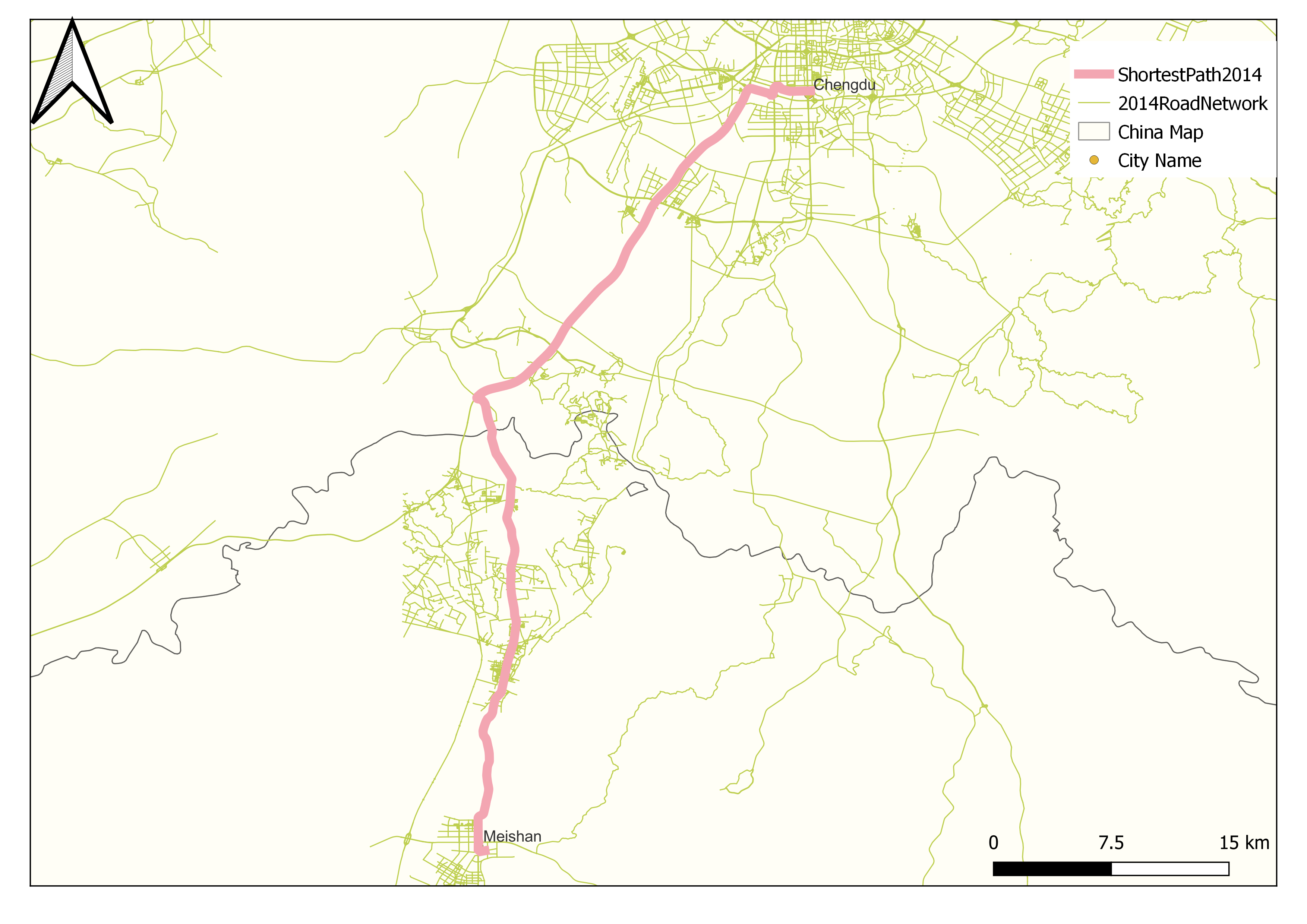
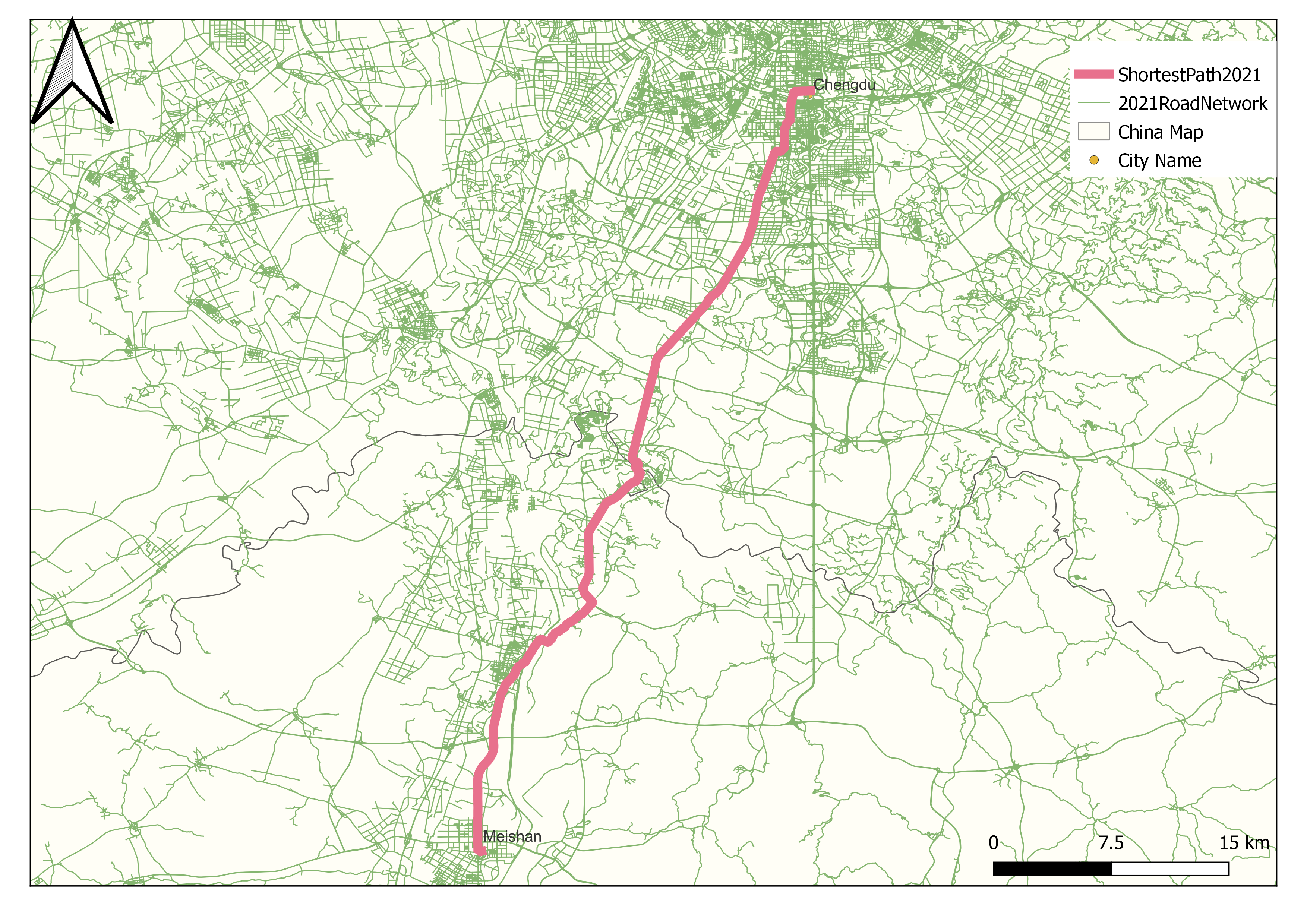
This portfolio entry showcases a network analysis comparing the shortest pathways between Chengdu and Meishan for the years 2014 and 2021. Utilizing QGIS, the analysis evaluates the changes in road selection, highlighting the infrastructure developments and urban expansion in the region over this period.
Analysis Overview
The network analysis was conducted using QGIS tools to determine the shortest routes between the two cities, Chengdu and Meishan, based on road network data from 2014 and 2021. This comparison reveals significant shifts in the preferred pathways due to new road constructions and upgrades, reflecting the rapid urbanization and regional connectivity improvements.
Key Findings
- 2014 Analysis: The shortest path primarily utilized older highways and local roads, with limited expressway options.
- 2021 Analysis: The development of new expressways and the expansion of the road network led to a more efficient and quicker route, reducing travel time and enhancing connectivity.
Visualization
The analysis results are visualized in the network maps below, illustrating the evolution of the road network and the resultant changes in the shortest path between the two cities.


Tools Used
- QGIS: For performing the network analysis and generating the maps.
- Data Sources: Road network data for 2014 and 2021 are obtained from Openstreet Map.
This analysis provides insights into the impact of infrastructure development on regional connectivity and urban planning.
